Context without competition
Aerial imagery and surrounding geography stay visible, but muted enough to support the subject instead of becoming the subject.
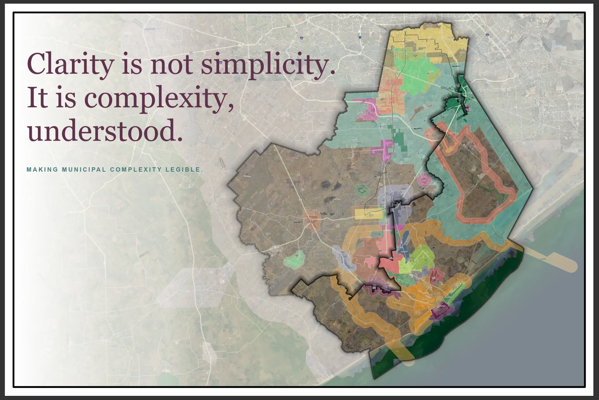
Project branding and identifying details have been removed. Geography shown is based on publicly available data.
THE CARTOGRAPHIC QUESTION
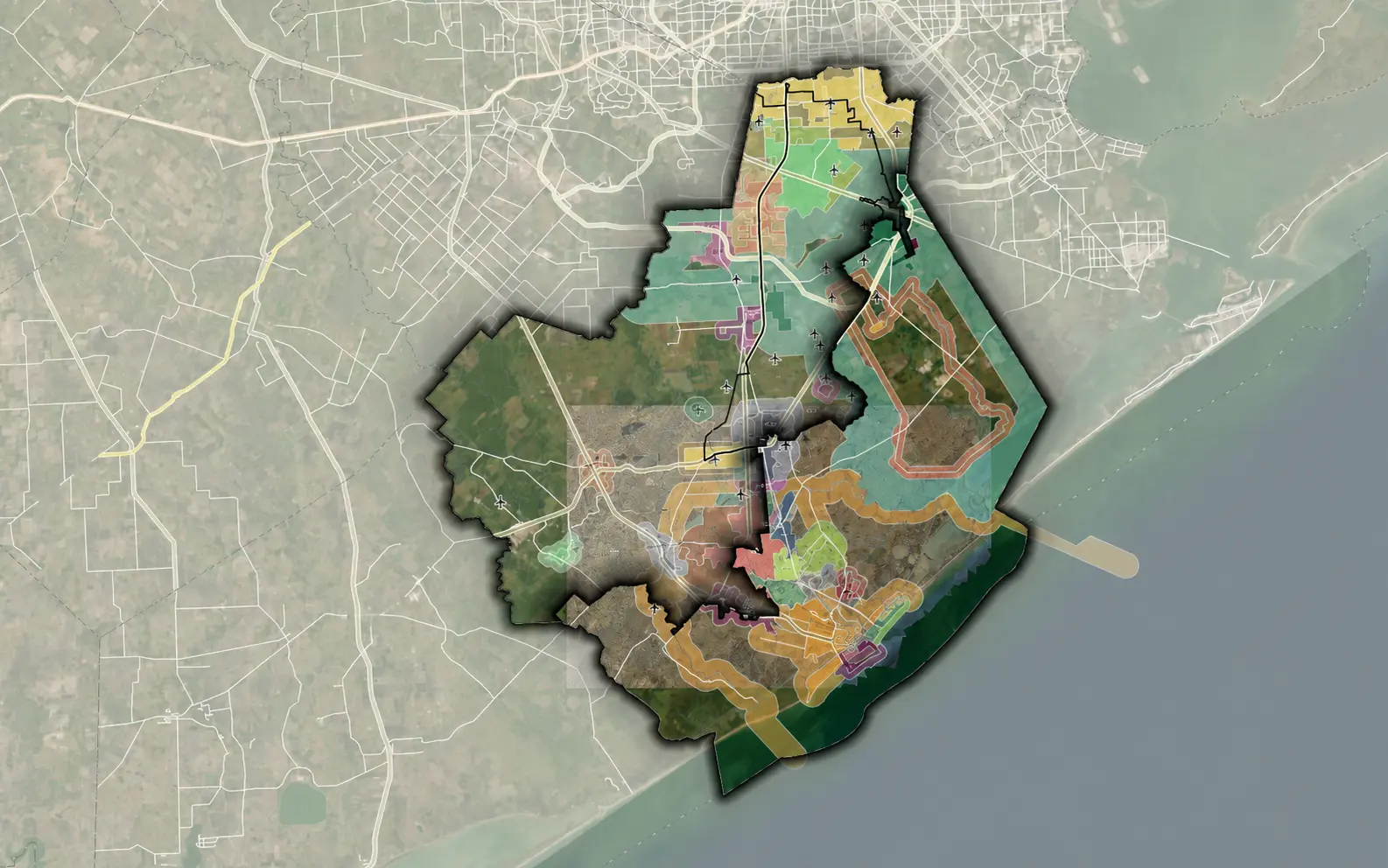
The exhibit needed to show a focal municipal area as part of a much larger system: county and precinct boundaries, cities and ETJs, transportation, drainage, airports, imagery, and neighboring geography. The work was not simply adding layers. It was deciding which relationships needed to be seen first, second, and only after a closer look.
THE DESIGN SYSTEM
Aerial imagery and surrounding geography stay visible, but muted enough to support the subject instead of becoming the subject.
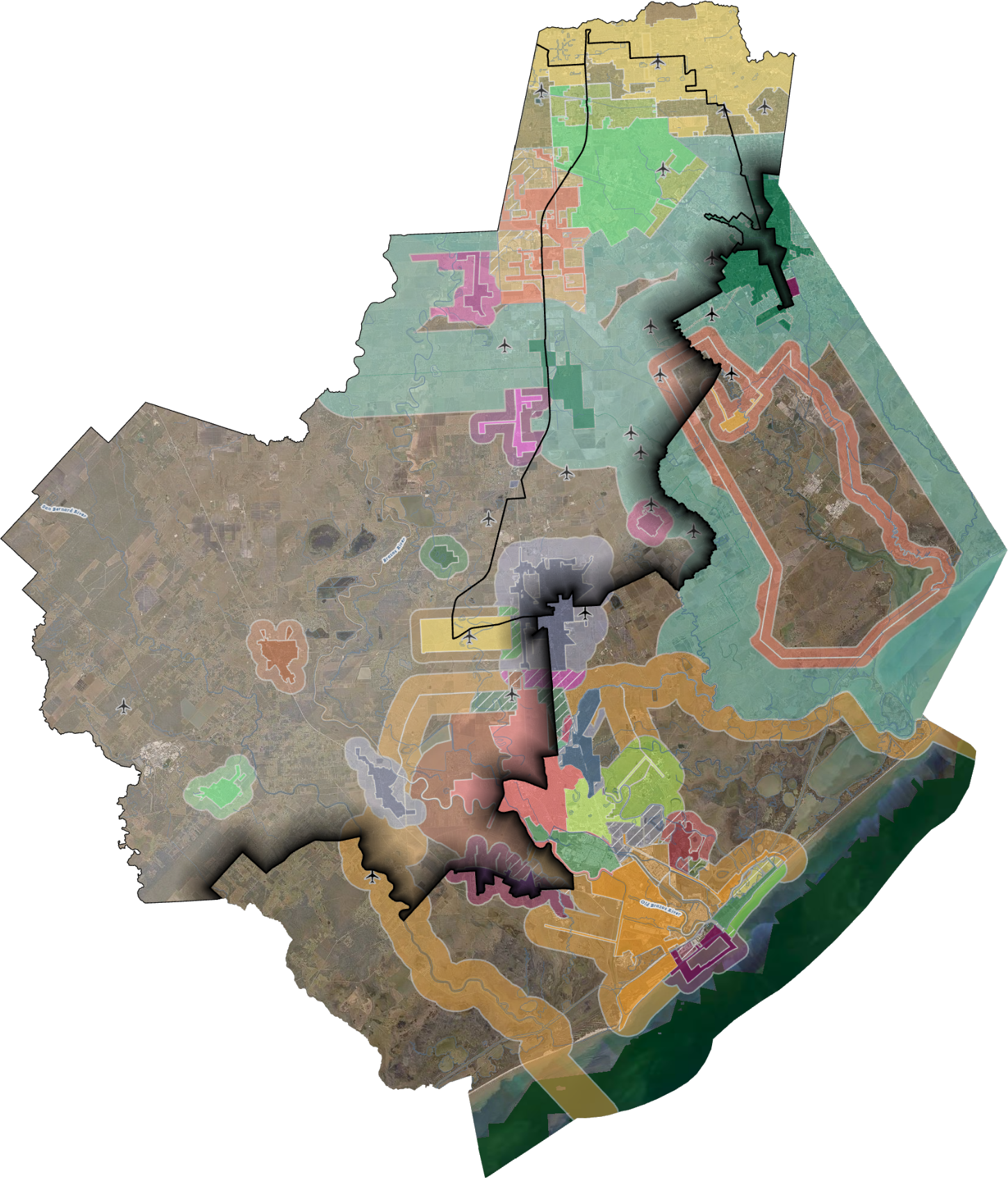
County, precinct, city, and ETJ areas use distinct color, weight, transparency, and edge treatment so overlapping jurisdictions remain traceable.
Roads, channels, airports, and place labels are present at the level needed to orient the reader without giving every feature equal visual weight.
Masking, vignette, and controlled shadow separate the focus area from its surroundings while preserving the regional relationship.
INSIDE THE WORK
In ArcGIS Pro, the finished hierarchy came from repeated adjustment: transparency, color relationships, line weights, labels, masking, vignette, and the balance between a regional overview and local detail. The working view shows the layers and symbology behind a result that is meant to feel composed rather than crowded.
“Beautiful” was not decoration added at the end. It was the discipline of making complexity easier to read.
THE RESULT
At a glance, the reader can find the focal area and understand its regional position. Closer inspection reveals the jurisdictional, transportation, environmental, and municipal relationships supporting it. The exhibit stays operationally useful while carrying a visual identity of its own.
WHAT THIS SHOWS
The strongest map is not the one with the most information or the most dramatic styling. It is the one that understands what the reader needs to notice—and gives every other layer a purposeful supporting role.